|
Forums65
Topics76,491
Posts1,034,091
Members14,873
| |
Most Online80,173
Apr 25th, 2025
|
|
|
5 members (1 invisible),
52,755
guests, and
1,185
robots. |
|
Key:
Admin,
Global Mod,
Mod
|
|
|
M |
T |
W |
T |
F |
S |
S |
|
|
1
|
2
|
3
|
4
|
5
|
6
|
|
7
|
8
|
9
|
10
|
11
|
12
|
13
|
|
14
|
15
|
16
|
17
|
18
|
19
|
20
|
|
21
|
22
|
23
|
24
|
25
|
26
|
27
|
|
28
|
29
|
30
|
31
|
|
|
|
|
|
|
Joined: Jan 2010
Posts: 1,909 Likes: 4
Forum Addict
|
OP

Forum Addict
Joined: Jan 2010
Posts: 1,909 Likes: 4 |
I have been interested in a stream which originated - I think- somewhere near Mount Road. It has long been largely culverted but traces of it can be seen in the Southwestern border of the Bebington Road allotments, where it enters a culvert by Kingsbrook way. From there on it becomes a sewer, but its course can be traced by the lie of the land as it goes downhill to a low point behind Tesco's car park, going under the Kings Arms car park and from there finds its way to the Old Chester Road via the streets behind the shops and garage. It then follows the Old Chester Road to Bebington station where it goes under the bridge and then runs along Greendale Road for a bit, turns left, skirting the Lady Lever Art Gallery passes the school and goes under the New Chester road at about the junction of Corniche Road and the A41. From there it skirts the Playing fields and arrives at the sewage works, where one might be able to catch a glimpse of it through the trees as it emerges briefly into a concrete channel.
Largely forgotten, it still occasionally pops up to remind us of its existence such as yesterday when heavy rain caused flooding in the Road by the Kings Arms and near the bridge ar Bebington station and along Greendale road. Evidently the flow was too heavy or perhaps there was an obstruction further down causing the drains to back up.
I would like to know what it was called. My suspicion is that it may have been called the Ash brook, based on the fact that the oldest houses along its route are in Ashbrook Terrace near Bebington station and would be grateful if anyone can shed some light on its history.It can be seen - unnamed - on some old maps before it was incorporated into the sewerage system.
|
|
|
|
|
Joined: Dec 2010
Posts: 2,293 Likes: 3
Forum Master
|
|
Forum Master
Joined: Dec 2010
Posts: 2,293 Likes: 3 |
|
|
|
|
|
Joined: Aug 2011
Posts: 155
Enthusiast
|
|
Enthusiast
Joined: Aug 2011
Posts: 155 |
|
|
|
|
|
Joined: Jan 2010
Posts: 1,909 Likes: 4
Forum Addict
|
|
OP
Forum Addict
Joined: Jan 2010
Posts: 1,909 Likes: 4 |
What a fascinating book. Many thanks for sending it. It confirms my tracing of the route, although unfortunately throws no light on the name of the stream if it ever had one.
Your mention of underground streams reminded me of my one and only abortive attempt at it at the age of ten. Our village in a South Wales valley had a brook which was fed by two culverted streams. One of them looked feasible to explore so a group of us and a dog set off to explore it. For some reason, we roped each other together like mountaineers although a crevasse seemed rather unlikely and entered the outfall. I was the leader. From the bright sunshine outside it took some time to adapt to the dark but we got about 50 yards in when to my horror, two red eyes appeared ahead in the tunnel. I stopped dead, and as my friends spotted the lurking horror we turned as one and ran in panic for the exit. I think we all fell over and got soaked to the skin and emerged into the sunshine white and shaken - to be pursued by the monster. Which turned out to be the dog!
It had evidently gone ahead of us without any of us noticing!
We never recovered enough courage to reattempt it.
|
|
|
|
|
Joined: Nov 2009
Posts: 3
Beginner
|
|
Beginner
Joined: Nov 2009
Posts: 3 |
|
|
|
|
|
Joined: Jan 2010
Posts: 1,909 Likes: 4
Forum Addict
|
|
OP
Forum Addict
Joined: Jan 2010
Posts: 1,909 Likes: 4 |
Thanks, everyone for your helpful contributions. It looks very much as if it was the River Withert. I wonder if it got the name from drying up in dry weather - 'withering' in other words.
I find it sad that streams like this disappear and get forgotten about. I suppose when we are all dead and gone and mankind has passed and gone it will eventually reassert itself.
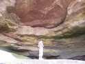
One of the links took me to a mention of the Rubicon. This used to run below Borough road, and in heavy rain was prone to flood. In the 1950s, I think, it was decided to do something about it and at about the junction of Borough Road and Clarence road, there is an underground weir. When the flow gets too high, it overflows the weir and goes into a tunnel leading back up towards Everest Road by the Tranmere Rovers stadium.
It then takes a sharp left and dives through a deep tunnel running 30 metres below Everest road, passes the Sportsman pub and goes below the park until it reaches Albany road at about Inglemere Road. It then runs below Albany road and St Pauls road and comes out into the river underneath the jetty in the oil terminal. The portal can be seen if you are in a small boat on the river.
At least it used to. I suspect it has now been intercepted at the Junction of St Paul's Road and the Rock Ferry bypass and finds its way to the underground pumping station at the bottom of the Dell where it is pumped to Bromborough treatment plant.
We rarely think about the infrastructure that removes our waste and rainwater. Who, sitting in the Sportsman pub of a wet evening is aware that deep below him is a torrential river flowing through a six-foot diameter tunnel on its way to the sea.
|
|
|
|
|
Joined: Jul 2008
Posts: 14,516 Likes: 32
Wiki Master
|
|
Wiki Master
Joined: Jul 2008
Posts: 14,516 Likes: 32 |
A couple of bits about this stream when talking about the Higher Bebington/Tranmere Border .... A well-defined stream course with its source in the highest point of the pine woods on the Prenton and Storeton boundary (about 75 yards west of Mount Road at its junction with Stanley Avenue marks the boundary for half a mile from west to east. The stream, now drained, after crossing Mount Road continued due east, cutting across Thornton Road and running along the northern side of Brimstage Avenue. After crossing King's Road, the force of the stream was slowed by the more gentle slope and the brook meandered its way in a south-easterly curve to the site of the King's Hotel, where until recently a meare (boundary) stone stood. At this point the brook turned sharply southwards following a clearly defined valley, As late as 1924 the stream was a water-course with a wooden bridge at its crossing with King's Road and it is marked on many maps (e.g. Map of Cheshire, 1846) prepared by Birkenhead Borough Surveyor. The spread of suburbia caused it to be piped and drained in places. Its name is puzzling—it has been suggested it was called (a) The Dale Stream and (b) The Withert. The latter name (c.f. Withert Avenue) is reputed to be a family name and there is no documentary evidence for the authenticity of the Dale Stream. Field name s throw no light on the subject. https://drive.google.com/file/d/0Bx...iew?resourcekey=0-cx4Dvs2z0phGd4ETo2TYgg Page 39 ... From Cheshire Local History Association https://sites.google.com/site/cheshirelha/cheshire-history-journal
We don't do charity in Germany, we pay taxes. Charity is a failure of governments' responsibilities - Henning Wehn https://ddue.uk
|
|
|
|
|
Joined: Jan 2010
Posts: 1,909 Likes: 4
Forum Addict
|
|
OP
Forum Addict
Joined: Jan 2010
Posts: 1,909 Likes: 4 |
I have heard the Ash Brook as the name too. Evidence exists in Ashbrook Terrace near Bebington station. The houses are old enough to have witnessed the brook before it became a culverted sewer.
I'm told it crosses the Railway the way we do, under the roar going under the railway bridge and unsurprisingly then runs under Brook street in Port Sunlight.
|
|
|
|
|
Joined: Jul 2008
Posts: 14,516 Likes: 32
Wiki Master
|
|
Wiki Master
Joined: Jul 2008
Posts: 14,516 Likes: 32 |
There are signs that there was another stream heading towards the Bebington Station area from the Highfield Road area, basically the railway line route. Its quite common that railways followed water as it was a quick/cheap way of finding and surveying reasonably level routes.
We don't do charity in Germany, we pay taxes. Charity is a failure of governments' responsibilities - Henning Wehn https://ddue.uk
|
|
|
Click to View Topic.
|
|
|
Posts: 2,366
Joined: April 2009
|
|
|
There are no members with birthdays on this day. |
|
|
|
Lucy Letby
by diggingdeeper - 16th Dec 2024 7:16pm
|
|
|
|
![[Linked Image]](http://nwex.co.uk/temp/culverts/c1.jpg)
![[Linked Image]](http://nwex.co.uk/temp/culverts/c2.jpg)
![[Linked Image]](http://nwex.co.uk/temp/culverts/c3.jpg)
![[Linked Image]](http://nwex.co.uk/temp/culverts/c4.jpg)
![[Linked Image]](http://nwex.co.uk/temp/culverts/c5.jpg)


