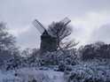
SNOW fell on Merseyside today as parts of the country braced themselves for 4 inch drifts.
But Met Office forecasters have said unlike the snow before Christmas the latest fall is not here to stay. The North West is set for snow, sleet and rain over the next 24 hours with the weather brightening into tomorrow.
The maximum temperature will be 4°C.
Helen Chivers, forecaster at the Met Office, said: "Really, it’s just normal wintry weather we’ve got over the next few days. As we go into next week it’s going to be very much milder."
Severe weather warnings of heavy snow were issued by the Met Office for parts of Scotland while heavy rain was expected in London and eastern and south-eastern England. Cumbria was set for further snowfall.
This week the Met Office issued figures showing that last month had been the coldest December since records began 100 years ago.
Wirral was hit by showers of snow and sleet as wintry conditions returned earlier today.
Merseytravel says train, bus and ferry services are all running normally.
A spokesman said rain was forecast for this afternoon, adding that should the adverse weather conditions continue, travel updates would be issued.
Wales saw the worst of the snow, with up to 2ins settling in some areas, especially over higher ground.
A band of wintry showers of snow and sleet was expected to spread north and east from Wales and the Midlands to northern England before reaching southern Scotland later.
A spokesman for MeteoGroup, the weather division of the Press Association, which supplies weather updates to the Globe webite, said: "Wales have had the worst of the snow so far but it's heading northwards.
"It's gradually turning to rain in the south as milder conditions come in. By the time the band gets up to southern Scotland it's turning to rain almost everywhere else."
Temperatures are varied but there are signs that milder conditions are on the way, with southern England hitting 10C-11C (50F-52F).
In northern England, however, the mercury is unlikely to go above freezing (32F) or 2C (36F).
The mixed picture is set to continue into the weekend, which will feature snow showers, rain and dry spells.
"Much of England and Wales will clear up tomorrow for a better afternoon," said the MeteoGroup spokesman.
"But there will still be some wintry showers in Wales, north-west England and southern Scotland."
Forecasters said the snowfall will give way to a milder spell going into next week with temperatures that could reach as high as 13C (55.4F)
![[Linked Image]](http://images.icnetwork.co.uk/upl/liverpoolecho/jan2011/1/3/liverpool-snow-january-7-65848021.jpg)


![[Linked Image]](http://img268.imageshack.us/img268/9940/334766523006ccdm3.jpg) Please do not adjust your mind, there is a slight problem with reality
Please do not adjust your mind, there is a slight problem with reality