The Wirral WW2 defences, and in particular Birkenhead.
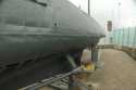
![[Linked Image]](https://c8.staticflickr.com/1/661/32056835455_95370e7cf4_b.jpg) birkenhead defences-1 01-01-17
birkenhead defences-1 01-01-17 by
y10694, on Flickr
We obviously feared that the Germans could hold a limited invasion of the Wirral, with a seaborne invasion along the Leasowe beaches, and with airborne troops landing at RAF Hooton (mentioned), and probably RAF Sealand, and other flat fields in the area.
Birkenhead was essential to the war effort, as it is on the Mersey, across from Liverpool. The capture or disruption of Birkenhead would have been a disaster, as it would disrupt the WW2 activity in Liverpool, on the Mersey, shipyards and the Irish Sea, the Atlantic convoys and affect the use of Liverpool as a command and control centre.
Birkenhead was declared to be an "Anti-Tank Island", with several rings of defences. It even earned a place in the English Heritage book "Beaches, fields, streets and hills... the anti-invasion landscapes of England, 1940" as the Bromborough Pool A41 bridge was so important. The book is only available 2nd hand at over £150 now. The book does not have any maps of the Birkenhead Defences.
The EDOB (Extended Defence of Britain) database lists all known Wirral artefacts, but they appear to randomly spread across the Wirral, each in isolation and quite meaningless. The EDOB is a Google Earth kmz file download here:
Extended Defence of Britain - Google Earth Overlay (kmz) However, I found the precursor chapters of the book online in the ADS website pages, available to download. The chapter for Bromborough Pool bridge does include a map - obviously removed for space issues (or secrecy ?). However, the map is geographically inaccurate, and has no key. But, all the same it's a great find.
Bromborough Pool Bridge - a defence study As a challenge, I've mapped the defence map onto Google Earth, and created my own copy by correcting the geographical errors, and adding a bit of inspired guesswork to a degree that it all makes sense, more or less. It's quite accurate in the rural areas, but very hard to follow in the urban areas.
PLEASE NOTE THAT THE URBAN AREAS ARE ALL APPROXIMATE LOCATIONS BECAUSE OF THE POOR QUALITY OF THE ORIGINAL MAP.
The defence lines tend to follow 'natural' lines of defences, and major roads.
My key is:
Blue line - Leasowe beach defences - usually large concrete cubes, cylinders and 'dragons teeth'.
Red - outer defence circle, anti-tank blocks, anti-tank ditches, pillboxes, pre-aimed weapon locations. Also a small circle around Wallasey.
Green - inner defence circle, anti-tank blocks, anti-tank ditches, pillboxes, pre-aimed weapon locations. Also a line of Anti-tank defences down along Woodchurch Road - obviously an expected German route into Birkenhead.
Purple - South Wirral defensive line - roughly from Hooton to Neston.
Yellow - appears to follow the A540, A41 and a route between them through Birkenhead - we have to assume that it represents supply / essential roads.
The red cross is Bromborough Pool Bridge
The other small black crosses (sometimes !) represent structures, ie Pillboxes - perhaps all were not built.
Birkenhead WW2 Defences PKP.1 Google Earth Kmz (this will require downloading, and opens in Google Earth):
Google Earth KMZ of the Birkenhead Defence Lines in WW2