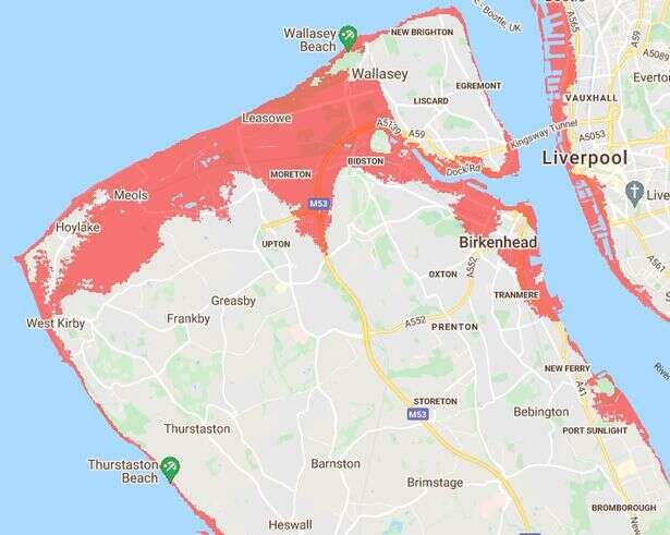
Will your home be safe from sea rising -map
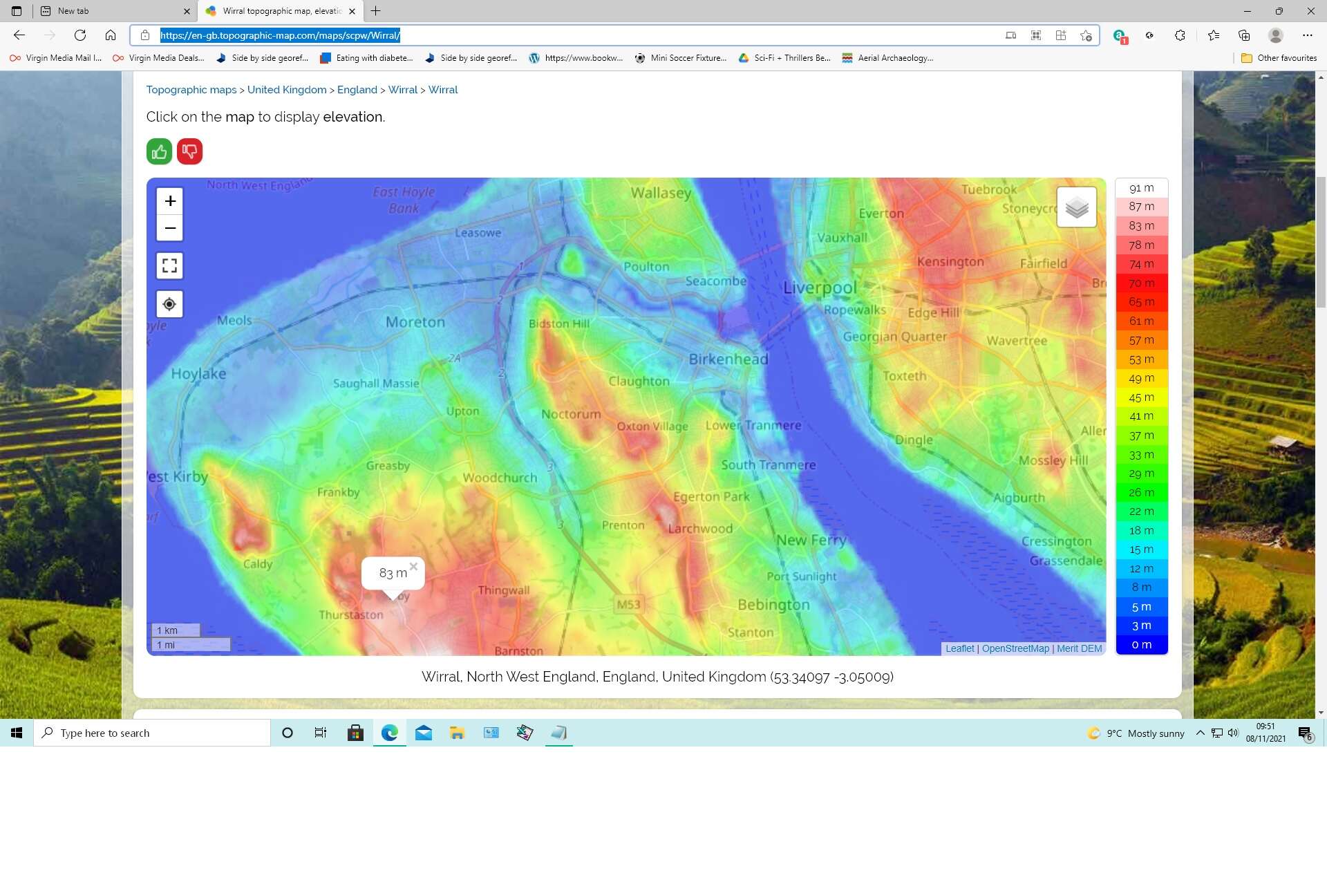
https://en-gb.topographic-map.com/maps/scpw/Wirral/Wirral topographic map, elevation, relief


Interesting map! Wallasey could so easily become an island, as it must have been long ago in high tides and stormy weather. There's not much going for Leasowe in that scenario, is there? Eek...
Much of Leasowe is reclaimed land though the purpose of the reclaimation it is uncertain.
Both the Wallasey and Leasowe embankments appear to have been built by the respective respective town commissioners which is strange as you would think they would have been something to do with with Leasowe Castle which was privately owned.
I can only guess it was tied in with the horse racing which probably brought a lot of capital in to the area. The Wallasey Embankment was started in 1829 (but was considered long before that) and was owned jointly by the Town Commissioners, the Mersey Docks and Harbour Board and the Mersey Conservancy. It enabled them to set a levy on the land it protected and might have been a way of extracting money from Leasowe Castle's profitable activities.
That is all pretty much guesswork, I'd be interested to know more.
Most of Wallasey looks like it will be safe, but it certainly does look bleak for most of the North Wirral area if the projections are correct.
Glad I left Moreton long ago!


