The radar site beside Levers Causeway has Stanley Avenue on the other side, this had a WW2 rocket projector, does anybody now whereabouts this was located?
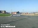
There is a path at the end of Stanley Avenue that continues to a building of sorts that was there in 1970 (before mobile sites), does anybody know what this is? 3 pictures are attached, I am wondering if it is just a pump station.
If from this building you go straight across to levers causeway, where the southern end of the copse joins the road. Right in the corner of this field there used to be some sort of concrete structure.
We don't do charity in Germany, we pay taxes. Charity is a failure of governments' responsibilities - Henning Wehn
That site pictured has been mentioned before, but I don't remember whether anyone knew what it was. Looking on Livesearch, it ought to be possible to follow the track to it from the end of Stanley Avenue. It may have something on it which would identify it. Any volunteers? I can't say I've ever heard of the rocket projector. Interesting.
I would hazard a guess that it's a sewage/water flow gauging point. Have seen similar green cabinets alongside surface water/sewage chambers before.
It's surely within a few minutes drive of local folk to nip along and have a look. Plates on cabinet, types of manhole covers, comms.connections, phone number displayed, sounds of running water ???
Hi-vis jacket, wellies, white hard hat, clipboard, confident manner. Go for it ....... and report back !
I will have a quick look tomorrow if I'm free. That green box does look like the sewage pump box, sometimes they have am orange light on top to remind you that you are up to your neck in sewage, when it has gone wrong.
I think this was the rocket launcher site - the sewage people might of taken advantage that there was already a path & eleccy there.
Source for Stanley Ave was "Birkenhead at War"
Rocket launch sites for Merseyside (from Pastscape):
ZH1 Noctorum SJ287 879 ZH2 Bebington SJ3074 8534 (which puts it at NW corner of copse, I think - but please check!) ZH3 Wallasey SJ 286 931 (is this New Brighton?) ZH4 Bootle (actually near Walton hospital) SJ355 954 ZH5 Newsham Park SJ376 920 ZH6 Princes Park SJ366 881
Interesting that Bebington has 8 digit location - but with the accuracy of other sites it may mean could be anywhere within eyesight.
I think this was the rocket launcher site - the sewage people might of taken advantage that there was already a path & eleccy there.
ZH2 Bebington SJ3074 8534 (which puts it at NW corner of copse, I think - but please check!)
Thanks for that info. Interesting that they give an 8 fig. ref. for ZH2 (+/- 10 metres). Using the current 1:25,000 (2 1/2 inches to the mile) O.S. map & measuring accurately with dividers, it puts the site half way between the NW corner of Marsh Hey Covert (which I played in as a child), & the site under discussion. I have no memory of anything there after the war, but I can't trust my memory any more! I wonder how accurate the ref. is; I would have thought very accurate, since they've used 8 fig.
Every site, each night needed 178 Home Guard personnel, therefore 1400 Home Guard were required for each rocket site !
That's an amazing number! More than Captain Mainwaring could have coped with!! My father was in the Home Guard (he was in a reserved occupation; shipbuilding). I wonder if he ever manned that site.
The rocket sites were apparently very "lightweight" and took up a lot of space. The only "concrete" they needed was a couple of square yards of 6 inch thick concrete to stand each launcher on, and a shed / nissen hut for storage, and one for the staff, so very little would remain. The concrete hard standings were usually in a regular pattern.
The launchers came in various "multiplicies" (my own word !), single, double, nines and 20's.
There were quite a number of rocket sites, as they were very cheap, easy to put up (all you needed really was flat field) - the opposite of HAA guns.
They tended to be favoured near ports for some reason.
it ought to be possible to follow the track to it from the end of Stanley Avenue.
You'll need to be a good climber - there's a big fence with a locked gate at the end of Stanley Av. You may be better off cutting accross the fields from halfway along Lever Causeway.
My Dad lived on Stanley Ave,in the Nissan huts I believe,after he was orphaned(late '40's)I'm not sure what he remembers about the area,but I will ask him,even better I'll get him to post his memories here himself I hope.
Great info! I wanted to know about gun sites in Higher Beb as my Dad was also in a reserved occupation in the HG and he cycled somewhere that way from Lower Beb, so that must be the place he went to. It's only when parents are gone that you wish you'd asked questions! Bri
hi,going off topic a bit but still ww2 does anyone know what was placed in wallasey central park in ww2,found a luftwaffer bombing map of wallasey targets and apart from the mills and gas works there is a item in the park around by where the bandstand would be that they have marked out,also does anyone remember the air raid shelter that was at the park entrance by martins lane/liscard road,can't find any info on any of these but you can still just about see the marking on the grass where the walls once stood at the shelter entrance.
Hope this works it is the first time I have used a forum.
I read your post with interest as I was born in June 1947, and lived with my mother in a hut in Stanley Avenue from the June to October in that year, after which she reluctantly gave me up for adoption.
I am in the process of tracing my family history, and any more information you could give me would be greatly appreciated.
Great info! I wanted to know about gun sites in Higher Beb as my Dad was also in a reserved occupation in the HG and he cycled somewhere that way from Lower Beb, so that must be the place he went to.
Having got his H.G. Enrolment Form, it's signed by the Adjutant and Cmdg. Officer of 139th.'Z'A.A.Battery. The excellent book 'Birkenhead at War, 1939-45'(Ian Boumphrey) states that Stanley Ave, was 214th. Battery. Can anyone clarify the numbers and where would 139th. Battery have been? The signatures are Griffiths and A.S.Chambers and the latter got the M.B.E. in 1945, according to the book.
There were only 2 "Z" battery sites on the Wirral, New Brighton and Stanley Road. The main reason for the "Z" rocket system was that it was very cheap and easy to manufacture, at a time when we could not manufacture the complicated HAA guns as fast as what we would like, and we never had enough of them anyway.
Those of us at the posh Cheshire end of the Wirral, take note that Google Earth v6 now has aerial photography back to 1945 (in glorious b&w). Presumably the rest of the Wirral will follow in time.
Thanks for the Google Earth update inf. Alas, my Lower Beb is just off in the blank bit. I'm intrigued to know who/how they did this at the end of the war. Presumably RAF photographic reconnaisance would have had this kind of technology, but kept it secret.
I've been going through the Wirral WW2 Decoy sites and getting aerial photos from the war period, and they (National Monuments Record NMR ) have been very helpful. It's a tiresome prosess, give them a modern OSGB reference, they tell you what they have, and then you order photocopies or whatever from them. They are very helpful. They have not failed yet for the Wirral (or Merseyside).
The Google Earth date is always 1/1/45, so I guess it is really a bit of a compromise.
The German Luftwaffe recconaisance images are held by the USA.
The images that I have been suplied with are all RAF vertical images. They appear to have oblique (sidewards looking rearwards) images of the coast.
Bit off topic. My mum went to Holt Hill convent and she tells me they had AA battery posted in their school playground, any confirmation?
Sister Mary Campion, who is archivist and historian for the FCJ sisters, relates that a barrage balloon was sited on the hockey field at Holt Hill Convent from April 1940, but there is no record of an AA battery.
There appears to be a large number of huts to the SW of Stanley Road, with the actual rocket site on both sides a little further south, with some disturbances of the ground showing which are probably the rocket launcher bases.
Coming rather late to this thread but I am pretty sure the tripod like bases for the Maunsell Forts in the above photo are still there just off the bottom of the slipway at Rock Ferry near The Refreshment Rooms.
The Mersey forts were built at Bromborough dock but were stationed out in Liverpool bay so I don't think there would be any remains near Rock Ferry. There was a pier with a crane at the location you mention and it's mentioned in a thread here, but I can't remember the details now.
The bases you are looking at are the remains of the old Tranmere Oil Terminal.
The pier was originally much shorter (same length as slipway) and had a bridge leading to the floating ferry terminal on the end but after the ferry closed the bridge and landing stage was removed in 1957 and the pier extended to become Tranmere Oil terminal. Pretty sure some ship hit it at some point and wiped out the end of the pier.
We don't do charity in Germany, we pay taxes. Charity is a failure of governments' responsibilities - Henning Wehn
the tripods were for the pipe-line for the oil-tankers to discharge their load. the line went a good way out as the ships were getting to super-tanker size. (a snippet of useless info is that it took the tankers 14 miles to stop and the captain of one ship miscalculated and hit the jetty which cracked the approach roads (i think the first one was Bedford Place then accross New Chester Rd and up to top of Bedford Rd., across r/about and small cracks were found in Bedford Drive) that must be between 1+1/2-2 miles,some power and i meant to say that there was a pill-box on the shore-line down from the jetty by the Dell Primary school,cheers
The reason for the oil terminals and facilities at Tranmere is quite complex. It started during WW2, when we realised we could not use East Coast ports for oil. We only had 2 main oil import facilities, Stanlow Island Dock at Shell on the Manchester Ship, and Avonmouth. There was a small facility in Bromborough Pool dock.
The issue was that if the Germans bombed Eastham Locks, then it meant that we lost use of the facility, and our oil imports would be halved.
Therefore, we quickly built additional facilities at Bromborough Pool and Tranmere, and a pipeline built to Stanlow / Backford. Unloading at Bromborough / Tranmere also saved time on the tanker turnaround by a day or so, and enabled the tankers to make one more transatlantic trip a year.
We also built new storage facilities at Avonmouth inland (they were on the coast), to make them more survivable, and pipelines between them and the coast. We also built armoured oil tanks at Immingham - flat countryside and difficult to bury oil tanks.


![[Linked Image]](https://www.wikiwirral.co.uk/forums/ubbthreads.php/ubb/download/Number/14032/filename/P1010778rs.jpg)
![[Linked Image]](https://www.wikiwirral.co.uk/forums/ubbthreads.php/ubb/download/Number/14033/filename/P1010776rs.jpg)
![[Linked Image]](https://www.wikiwirral.co.uk/forums/ubbthreads.php/ubb/download/Number/14034/filename/P1010844.jpg)
![[Linked Image]](https://www.wikiwirral.co.uk/forums/ubbthreads.php/ubb/download/Number/14035/filename/P1010842.jpg)
![[Linked Image]](https://www.wikiwirral.co.uk/forums/ubbthreads.php/ubb/download/Number/14036/filename/zbatteryfiringmultiples.jpg)
![[Linked Image]](https://www.wikiwirral.co.uk/forums/ubbthreads.php/ubb/download/Number/14037/filename/P1010838.jpg)


![[Linked Image]](http://i11.photobucket.com/albums/a154/uggla03/111.jpg)


![[Linked Image]](http://farm6.static.flickr.com/5133/5405127963_f3f64f8281_m.jpg)