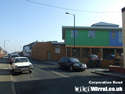
On 15th July 1969 the Tunnel approach roads and flyovers were opened to traffic. Their aim was to reduce traffic congestion in the town centre, and in particular the arterials of Chester Street, Borough Road and Conway Street.
Work took a couple of years, and as soon as this was nearing completion, the Grange Precinct was starting and so a lot of old housing stock and shops went the way of the demolition man.
There are a number of topics on Wiki concerning the flyovers, with pictures and documents. I was granted some unprecedented access to the works at the time. Here I have compiled some of my own unpublished pictures and videos of the flyovers over a number of years and presented them as a YouTube for your enjoyment.
This is Part 1, concentrating on Conway Street, and published on the 48th anniversary of their opening, although a public viewing took place a few days before. I hope to produce a Part 2, concentrating on Borough Road - providing this one goes well.
Well done Norton. Some of use well remember the traffic hold ups to the tunnel before the alterations to the tunnel approaches and the building of the flyovers.
Ships that pass in the night, seldom seen and soon forgoten
Excellent, I remember the morning one and a half mile queue up Borough Road to Tranmere Rovers before the flyover and road widening was developed. I never understood at the time why the Conway Street flyover was built, it didn't seem that necessary.
The flyovers were a quality build, they have had minimal maintenance compared to other projects.
We don't do charity in Germany, we pay taxes. Charity is a failure of governments' responsibilities - Henning Wehn
The tunnel flyovers were one of the biggest monstrosities ever to be inflicted on Birkenhead.
I admit I have an axe to grind, because our little community was among those wiped out to make way for them.
That apart, they were an over-the-top, ill thought-out, brutalist solution to a problem that was already on the way to being solved, as is made clear in this article from the Chris’s British Road Directory website ...
Even as the flyovers began operating, the Wallasey tunnel was under construction. It opened just two years later and would help relieve Birkenhead’s traffic congestion.
Meanwhile, back at the Birkenhead tunnel, the computer system designed to efficiently marshal the traffic didn’t work.
The planners were undoubtedly thrilled by their futuristic vision of building sweeping roadways in the sky. Who cared if 170 homes, 90 shops, 23 factories and 14 pubs had to be demolished?
Admittedly, the old heart of Birkenhead that was torn out by the flyovers was never the prettiest place. But it was incomparably better than the ugly, blighted, empty wasteland of concrete and tarmac that has been left in its place.
The flyovers are worth commemorating, if only to remind us what bad planning can do to a town. Fifty years on, I still curse them.
I suspect that the real reason for Birkenhead's flyovers was that they were fashionable in the '60s and Liverpool were building them in their town centre.
There are usually better way of controlling traffic that are no quite so disfiguring. Certainly in the 1960s they were not needed in Birkenhead, and even now, could be largely done away with and replaced by roads.
Well, enjoy them whilst you still can. More and more towns are demolishing them having realised that they are a lazy and disfiguring way of handling traffic. Time has moved on, and they are no longer seen as beneficial to traffic.
Surely nobody would regret the departure of Birkenhead's crop of these ugly monstrosities. The Conway Street one has gone, and I would be very pleased to see the borough road one going too.
If you don't have multi-level crossings, the only other options are either knocking everything down and start the whole town plan again with housing beside businesses or knocking loads of buildings down to create 6 lane wide roads to cope with the necessary batching of tragic.
I would personally prefer tunnels but they cost more.
In the future it will be possible to control all traffic with autonomous systems but we aren't there yet and some people prefer the higher accident rates of individual drivers
We don't do charity in Germany, we pay taxes. Charity is a failure of governments' responsibilities - Henning Wehn
I bought a map at the weekend from an antique fair stall in Peterborough for a couple of quid, and I thought of this thread.
It is an 1955 edition of an OS 25 Inch map of the centre of Birkenhead that is copyright dated from 1967, but is unusual in that it has been (very, very neatly) hand annotated (looks professional to me).
It has the tunnel approach roads drawn in, over the top of the buildings that preceded it, and a circle showing ‘1/4 mile radius from Central Hotel’.
‘Tetley hostelries’ are shaded in red, and ‘Other hostelries’ are shown in green (I think – I don’t have it to hand at the moment), whilst ‘Other demolished areas’ are shown in yellow hatched (large swathes of housing are yellow hatched).
The map has the appearance of the CRDB ‘Engineering Diagram’ in that link that Yoller posted back in July, but shows the full approach system, not just the small section as shown on the CRDB website.
Does anyone know what this map may have been used for – seems strange that Tetley Houses have been singled out? A Tetley copy of what they were going to lose?
Sitting on a cornflake, waiting for the van to come.
Thanks for posting this - I've looked into the tunnel approaches scheme quite a bit, but haven't come across the map you have found. I'd be interested to see a copy.
It sounds like this map, as you say, was made for Tetley to show how their properties would be affected.
The map could be based on the main maps drawn up by the contractors, Brian Colquhoun and Partners, which superimposed the planned flyovers over the existing buildings. Other maps delineated the many properties that would have to be demolished (see attachments).
Well the map hasn't got any contractors addresses/schedules, etc. on it (like your pictures) - it's just a standard OS, but with (hand?) annotation. It just looks like it's been done in a draughtsman's hand, which in turn makes me think it was intended for commercial purposes.
I'll take a digi-photo of it's salient details, then, if you're interested further, I'll try to cram it, bit by bit through my A4 scanner (which may be a struggle)
Might be a few days before I can post back though. Thanks for the interest.
Sitting on a cornflake, waiting for the van to come.